

The Next Cascadia Earthquake Will Redraw the Pacific Northwest Coastline
When Cascadia awakes, one of Oregon’s most popular beach towns may be the most at risk.
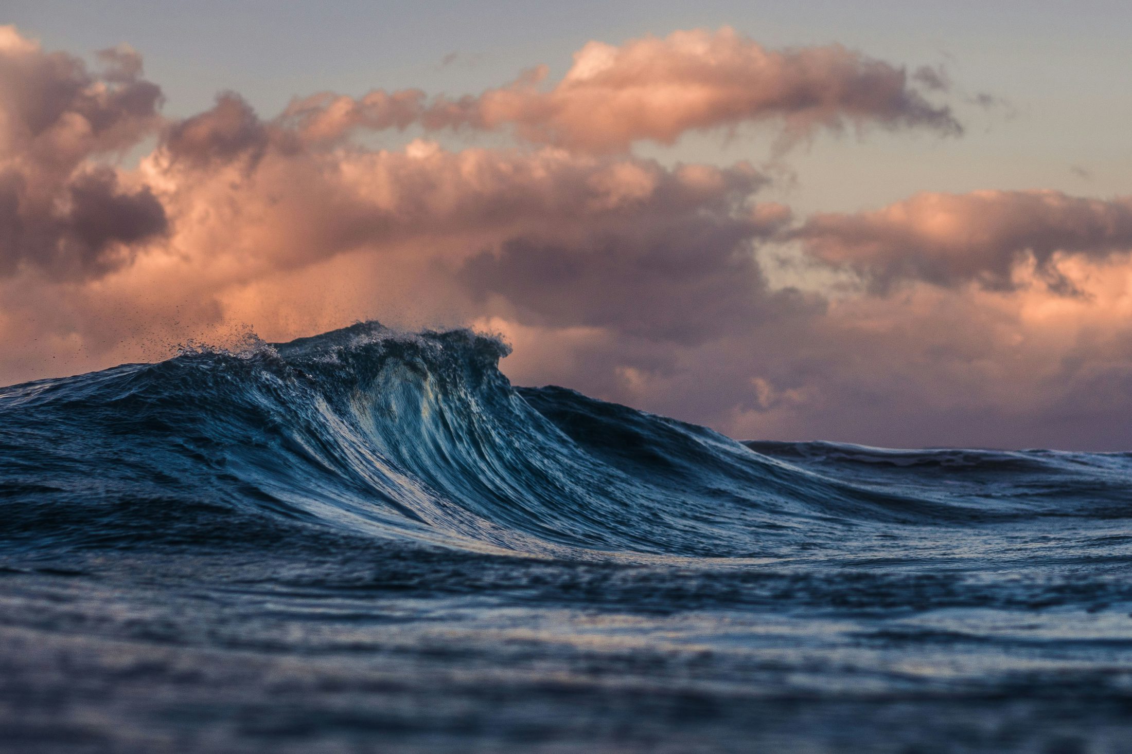
“Then they [Earthquake and Thunder] went north together and did the same: they kept sinking the ground. The earth would quake and quake and quake again. And the water was flowing all over.”
Yurok legend, “How the Prairie Became Ocean”
On a dark winter night in the year 1700, a major earthquake struck eighty miles off the Pacific Northwest coast of North America. The native inhabitants living in villages along the coast stirred from their sleep when the dogs began barking. The sound that followed was strange, like the roar of a great rushing wind. Then the ground began to heave side-to-side in a violent motion. The earth had shaken before in recent memory, but not so violently or for nearly as long. It was not possible to walk or stand until the ground became calm again.
During the quake, the sands on the beach shook so hard that they seemed to turn to liquid. Houses, people, and hearths with fires still burning in them sank into the ground. What wasn’t consumed by the shimmering sands was overcome by landslides of earth breaking free from the surrounding hills. Entire villages disappeared in a matter of minutes.
After the shaking subsided, during the crying and confusion, the first wave came. It was thirty feet high, and washed up the beach and over the land. Cold seawater raced up the hillsides, submerging coastal woods and smashing everything in its path. The wave that followed was even higher than the first. More waves came after that, every hour for many hours.
Some of the people remembered ancient legends told to them by their grandparents that warned of the ground shaking and the water rising, and fled to the tops of hills. The few who managed to escape the reach of the flood waters survived. But many hundreds of people, if not thousands, died that night.
Ten hours later and thousands of miles away, on the other side of the Pacific Ocean, a tsunami hit the eastern coast of Japan. The island nation of Japan was no stranger to tsunamis, but this one was different—the waves had struck without any advance warning. Usually a tsunami was preceded by an earthquake, but no one had felt the ground shake. Several villages along the coast were overwhelmed by the heightened waves, houses were lost to fire, boats overturned, and field crops destroyed.
The devastation was not as severe in Japan as it was on the opposite side of the ocean. However, local merchants, villagers, and bureaucrats documented what would later be called the “orphan tsunami” in their records, puzzled by the waves that seemed to spawn without origin.
At the time, no one could connect the two events on opposite sides of the Pacific. The indigenous people of North America didn’t have their own written record of the disaster, and by the time Europeans began establishing settlements along the west coast a century later, the memory of the great earthquake had already faded into local lore. For generations afterward, settlers built houses, towns, and harbors by the sea, unaware of the threat that lurked quietly offshore their paradise home.
For more than two centuries, the great earthquake of 1700 remained largely forgotten. But the evidence was still there, hidden in the geology of the coastline, waiting for science to take notice.
Ghost forests and tsunami sand
It wasn’t until the late twentieth century that geologists began digging into the estuaries along the coasts of Washington and Oregon, and found evidence in the sediment layers that something catastrophic had happened there in the not-so-distant past.
The eerie remnants of dead trees had begun rising up out of tidal marshes where they lay submerged for hundreds of years. What had happened to them was a mystery. The trees hadn’t declined slowly as they do naturally over time; instead, they had died suddenly from the shock of saltwater flooding the roots. Using a method called dendrochronology, scientists compared the growth rings in the dead trees with other living trees in the nearby forests, and were able to determine exactly when the trees had stopped growing. The results were remarkably precise. The last growth ring dated to the fall of 1699. Since trees don’t grow during the winter season, they could determine that the death of the forests happened sometime between that fall and the spring of 1700.
The ground beneath the ghost forests revealed more intriguing details. Below the thick layer of intertidal mud lay a thin deposit of grey sand. Beneath that sand was dark soil filled with plant roots and the charred remains of ancient cooking pits—evidence that there had been people living among the trees of the once above-ground forest. The arrangement of these layers revealed a dramatic story: the land beneath the coastal forest had suddenly dropped, and a wave from the ocean had surged inland, depositing sand across the drowned landscape. The only force capable of carrying it that far inland was a giant wave. A tsunami.
As the scientists dug even deeper, they found repeating patterns in the sand and mud. Each sand layer was an indication of a unique tsunami event, separated by centuries of sediment build-up from the tides. The catastrophe that occurred around the year 1700 hadn’t been the first of its kind. The evidence showed that at least four similar events had occurred over the last one thousand years.
Indigenous disaster lore
The indigenous people of North America had been firsthand eyewitnesses of these significant events for millennia. They didn’t write down accounts of them, but they told stories. In recent history, the inhabitants living near the west coast witnessed a disaster so great that it unified the lore across many tribes and hundreds of miles. The stories were passed down from generation to generation, from grandfathers and grandmothers to their grandchildren.
Among the Quileute people of Washington, legends speak of a fierce battle between Thunderbird and Whale that beat the earth, uprooted trees, brought down boulders, and unsettled the sea. Farther north, on Vancouver Island, the Nuu-chah-nulth tribe tell stories of mountain dwarves dancing around their drums; when a drum was kicked it made “earthquake foot,” which shook the land and caused the ocean to flood. In the south, among the Yurok of northern California, stories describe Earthquake running along the coast; with every step the earth sank and the water washed up over his footprints.
The southern tribes also have a legend of a great owl living in the earth; when it flaps its wings the ground trembles. The story is similar to one told on the far side of the Pacific Ocean in earthquake-prone Japan, of Namazu, “the Earthshaker”—a giant catfish living in the earth that causes the ground to quake and the ocean to splash with the thrashing of its tail.
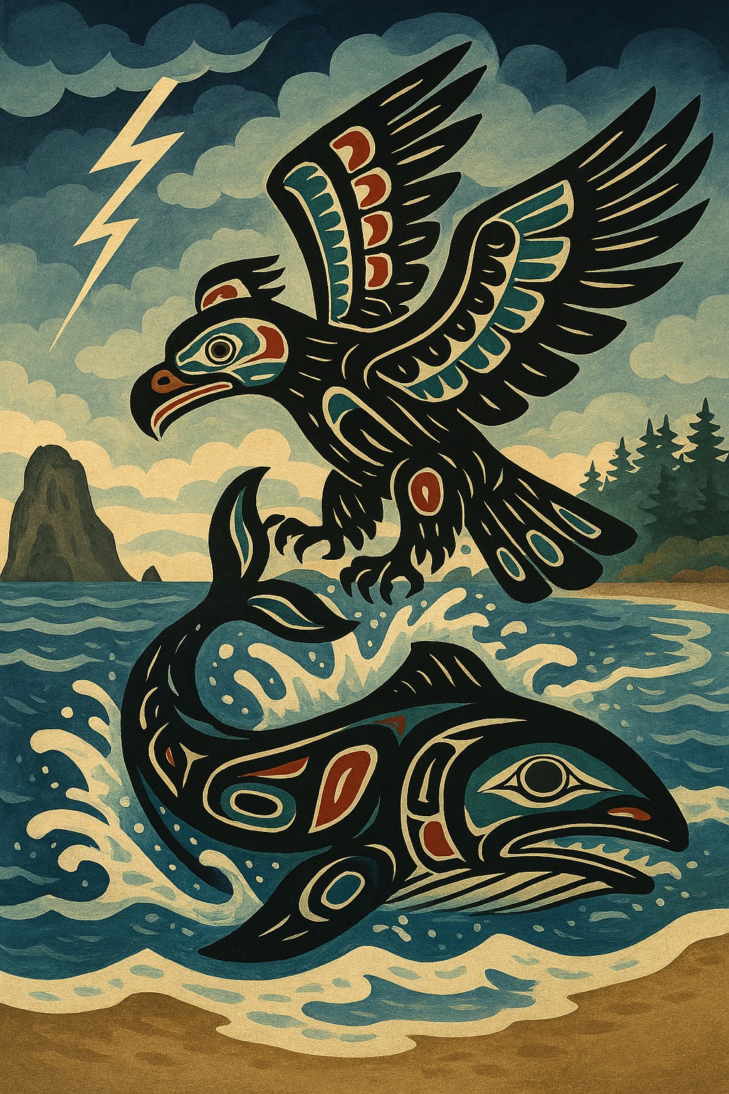
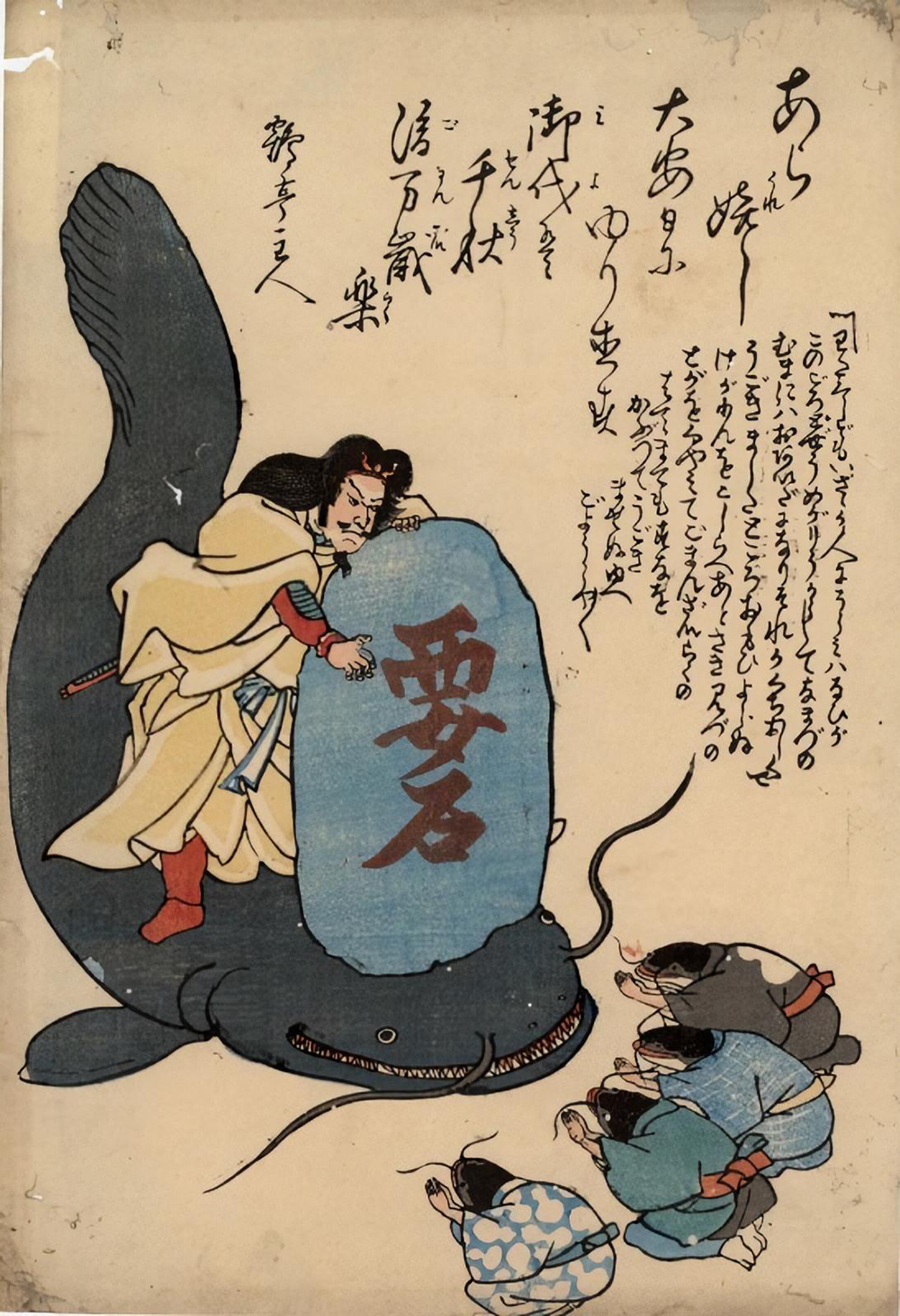
The symbolism differed from one culture to another, but the stories all shared a common theme: when the earth shook, the ocean would rise. For centuries these stories existed outside the scientific understanding of earthquakes in the Pacific Northwest. That began to change as researchers started piecing together the geological evidence of the massive earthquake that occurred around the year 1700.
One researcher heard rumors of the local lore and was intrigued by the things it was saying. She listened to the stories of the indigenous tribes all up the length of the coast and saw the similarities between them. When they spoke of Thunderbird and Whale battling, they seemed to be describing a great earthquake. Water flowing up over Earthquake’s footprints sounded like the flooding caused by a tsunami. Trees being uprooted and boulders being knocked down exactly described the landslides that would have resulted from a large earthquake. Maybe the people who had lived on the coast for thousands of years before Europeans arrived knew something that they didn’t.
Other scientists were taking note as well. One seismologist concluded that if an earthquake of such magnitude had occurred in the Pacific Northwest, it would almost certainly have generated a tsunami capable of crossing the Pacific Ocean. And if that had happened, there might be written records of it in Japan.
And there were.
He uncovered the Japanese historical accounts that described an unexplained tsunami striking coastal villages on a winter evening in the year 1700. By calculating the time it took tsunami waves to travel across the Pacific, he was able to trace the event backward to its origin. It was confirmed. A magnitude nine earthquake had indeed struck along the Pacific Northwest coast, and had triggered a massive tsunami on January 26, 1700, at around nine o’clock that night.
The orphan tsunami from history would at last have an origin.
The sleeping beast
The Cascadia Subduction Zone lies roughly eighty miles offshore the Pacific Northwest coast, stretching for nearly seven hundred miles from northern California all the way to Vancouver Island. For much of the twentieth century, scientists assumed the fault posed no threat, believing it was incapable of producing big earthquakes like those seen in other regions of the Pacific along the twenty-five-thousand-mile tectonic boundary line known as the Ring of Fire. But it was quickly becoming clear that Cascadia was not only seismically active, but capable of producing devastating megathrust earthquakes of the highest magnitude.
Unlike the well-known San Andreas fault in California—a strike-slip fault where the plates grind in a side-to-side motion—the Cascadia fault has much more violent tendencies. It is a subduction zone megathrust fault. Here, the dense oceanic Juan de Fuca Plate—a remnant of a much larger tectonic plate that once covered much of the Pacific Ocean—is slowly diving beneath the much larger North American Plate in a process known as subduction. And it’s causing a lot of friction in the process.
Plates converging at a subduction zone don’t tend to move easily; the two opposing masses will stick and become locked. The compression of the collision buckles the crust along the edge of the fault, pushing the coastline upward by as much as half an inch every year, while the oceanic plate continues pushing beneath it. Over centuries, pressure from the colliding land masses will accumulate like a compressed spring. But eventually, as with a spring, that energy must be released.
When the fault finally breaks, the seafloor shifts suddenly and the compressed land rebounds. Sections of coastline can drop several feet in a matter of minutes. The sudden movement of the ocean floor sends seawater barreling in all directions at speeds matching a jet airliner cruising at altitude. Earthquakes produced in this way can exceed magnitude nine and last for several minutes—far longer than the earthquakes most people are familiar with.
Evidence of these ruptures from Cascadia’s past is preserved miles beneath the ocean waves at the seafloor. Scientists studying the fault line have examined the layers of sediments left behind by underwater landslides triggered during major earthquakes, and from this have been able to reconstruct a surprisingly detailed timeline of Cascadia’s seismic past.
The results are unsettling. The evidence shows a history of frequent violent unrest on the Cascadia Subduction Zone.
The next fifty years
While the coastal sediments show a history of earthquakes spanning a thousand years, the offshore sediment record reveals a much longer history. More than forty major earthquakes occurred at regular intervals over the past ten thousand years. These massive quakes generated tsunamis just like the one that struck in 1700. Some ruptured the entire length of the fault at once, while others occurred along shorter segments. But taken together, the pattern revealed cycles of destruction followed by periods of relative calm.
The question on everyone’s mind is: When will it happen again?
Full-margin ruptures—those capable of exceeding magnitude 8.7—appear to occur roughly every three hundred to five hundred years along the Cascadia Subduction Zone. Partial ruptures (those exceeding magnitude eight) happen more frequently, particularly in the southern portion of the fault. We are now cruising into the 326th year since the last great Cascadia earthquake. While we can’t say exactly that another one is overdue, it does mean that we are sitting squarely within the window when the next “big one” could strike.
It hasn’t gone unnoticed that Cascadia has been unusually quiet compared to other subduction zones around the Pacific. Many faults tend to make seismic noise of some kind, reminding us of the explosive potential lurking at the ocean floor. But with Cascadia, the lack of any small-to-moderate seismic activity is an ominous indication that the plates are fully locked, quietly building up pressure for the next big release. It’s no longer a question of if it will happen, but when.
Probability experts have tackled the question of when, and suggest that there is roughly a thirty-seven percent chance of the next Cascadia “big one” occurring within the next fifty years—a megathrust earthquake with a magnitude eight or greater, where the fault line unzips itself like a heavy coat and sends a wall of seawater racing toward the land. When it happens, it will be one of the most significant natural disasters in North American history, second only to the earthquake that occurred in Haiti in 2010. On that day, the coastline of the Pacific Northwest will be redrawn, becoming virtually unrecognizable from what we know today.
In the path of terror
Along the Oregon coast, one community is particularly vulnerable to the next Cascadia disaster.
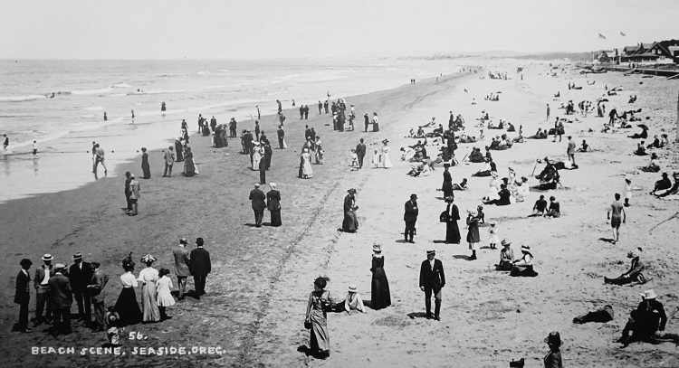
Seaside, Oregon, is a small coastal town that sits near the mouth of the Columbia River, about ninety minutes from the metropolitan hub of Portland. Since the 1920s it has been a favorite destination for beachgoers seeking a simple escape from the city. Seaside offers all of the expected pleasures of a picturesque beach town. Visitors can stroll along the oceanfront promenade and sample its candy shops and ice cream parlors, dig for clams at low tide, fly kites along the wide sandy beach, explore hidden coves, and feed seals at the local aquarium. On sunny weekends the population can swell dramatically into the thousands.
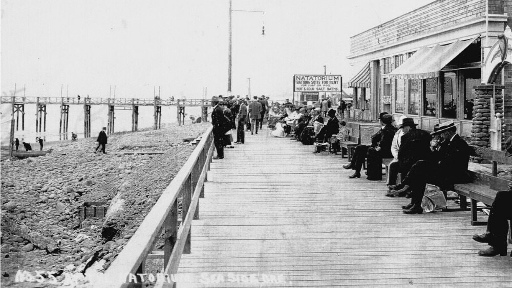
But almost the entirety of Seaside—including the beach, downtown district, residential neighborhoods, and critical services—sits inside the tsunami inundation zone, the low-lying area that will flood during a major tsunami. Between the low-lying areas and high ground are two waterways trisecting the city—the Necanicum River and Neawanna Creek. Reaching high ground requires crossing bridges that span these waterways.
However, of the eleven critical bridges in Seaside, built before modern seismic standards in the Pacific Northwest, only four have been retrofitted to be able to withstand a major Cascadia earthquake. The rest are expected to be damaged or completely destroyed. This will channel evacuees to the few other river crossings, causing major bottlenecks and potentially leaving people stranded with no way to get to safety.
It’s unlikely that most tourists are even aware of the risk, let alone have a plan for evacuation should the big one hit during their vacation at the beach.
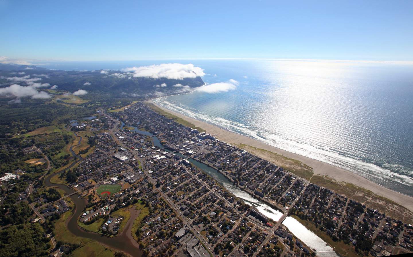
zone.
In a large tsunami event, fatalities in Oregon coastal communities are conservatively estimated to be eighteen thousand from the tsunami alone, a figure that doesn’t include fatalities from an earthquake or secondary injuries. Almost sixty percent of those deaths are estimated to happen in Seaside. That number could change by an order of magnitude depending on the season, day of week, and time of day. Visitor numbers increase during popular holidays and events, such as the annual beach volleyball tournament, and can swell to over fifty thousand in one day.
What the next Cascadia event could look like
No one knows exactly when the next Cascadia earthquake will occur, but decades of study have given us a good understanding of what is likely to happen when it does.
When the fault ruptures, centuries of accumulated strain will release in a matter of minutes. The shaking will start suddenly and intensify quickly, lasting far longer than the earthquakes most people in the Pacific Northwest have experienced.
Houses that haven’t been anchored will bounce off their foundations, tall buildings not built to seismic standards will collapse, bridges will twist and snap, and roads will crack. During intense shaking, loose soils beneath the town will begin to liquefy, turning firm ground into a churning slurry in a process known as liquefaction. Buildings will tilt and sink as their foundations lose support in the liquefied soil.
The ground will fail in other ways too—sinkholes, landslides, and lateral spreading, where large sections of ground slide sideways toward the sea, pulling buildings with it and damaging infrastructure. Fires will ignite from broken gas lines, downed power lines, and hazardous material spills.
During the time the ground is still shaking, the seafloor will be lifting and rebounding, which will displace massive amounts of ocean water, generating a series of tsunami waves that will begin racing toward the coast. Once the shaking ends, the clock will have already started ticking. In Seaside, where the shoreline lies close to the Cascadia Subduction Zone, the first wave will already be well on its way while people are still recovering from the shock of the earthquake.
The tsunami won’t look like a single breaking wave like those seen during storms. Instead it will arrive as a rapidly rising wall of water that pushes inland with tremendous force. The first wave will reach the shore fifteen to twenty minutes after the earthquake began, and within minutes water will flood the beach and pour into the streets of Seaside. Depending on the tide, the peak could reach fifty feet or more—high enough to reach the upper floors of the tallest hotels along the promenade. The surge will race toward the river crossings where thousands of fleeing people will likely be trapped with no way to cross.
Barely forty minutes after the start of the ground shaking, the entire city of Seaside will be under water.
After the first wave recedes, it will drag tons of debris and wreckage back toward the sea. But the danger won’t be over then because more waves will follow. The second swell could potentially be larger than the first and will carry more than just water; it will contain a swirling mass of shattered wood, twisted metal, chunks of concrete, and fractured glass, enough to crush bodies and tear apart buildings in its path. For hours the waves will continue to push inland. Even after the waves begin to subside, dangerous currents and deep flooding will remain.
Because the earthquake itself will cause damage to roads, bridges, and communication systems, rescue operations could take days to fully organize. Communities located inside tsunami inundation zones will be hit the hardest. For places like Seaside, the combination of geography and population will make evacuation extremely difficult.
Deaths will be caused by drowning, injuries from debris, tsunami lung—a typically fatal lung infection caused by inhalation of bacteria-contaminated water—and exposure. More will die because emergency facilities are overwhelmed and unable to accommodate all of the injured.
For the survivors, and any who choose to stay in Seaside in the aftermath, it will not be a matter of resuming daily life as usual. Critical infrastructure along the coast will be crippled for significantly longer than inland areas—not months, but years. That’s years before coastal communities will have clean drinking water, sewer services, electricity, and healthcare facilities. In Seaside, most residents will not simply be able to return home, as nearly everything that lies in the inundation zone will remain permanently under water.
Is Oregon ready?
The state of Oregon is woefully unprepared for this inevitable disaster.
Despite the scale of the risk, coastal communities in Oregon have begun taking steps to reduce their vulnerability. In 2020, voters in Seaside approved a bond measure to relocate both the city’s high school and middle school to higher ground outside the tsunami inundation zone. The new campus opened in 2021, removing hundreds of students and staff from one of the most exposed areas during the school day.
Other improvements remain at a standstill. Bridges over the Necanicum River and Neawanna Creek are critical evacuation routes, yet several remain that require seismic upgrades. Retrofitting them could cost an estimated thirty million dollars—a significant sum that the city has struggled to raise. Efforts to raise additional revenue, including a proposal to increase the local lodging tax, have faced political and economic hurdles.
Emergency planners have also studied the possibility of constructing vertical evacuation structures—reinforced towers or platforms designed to lift people above tsunami waters when there is not enough time to reach natural high ground. Other Pacific Northwest communities have already begun building such structures with the help of federal grants and private funding, paving a path forward for other communities to follow.
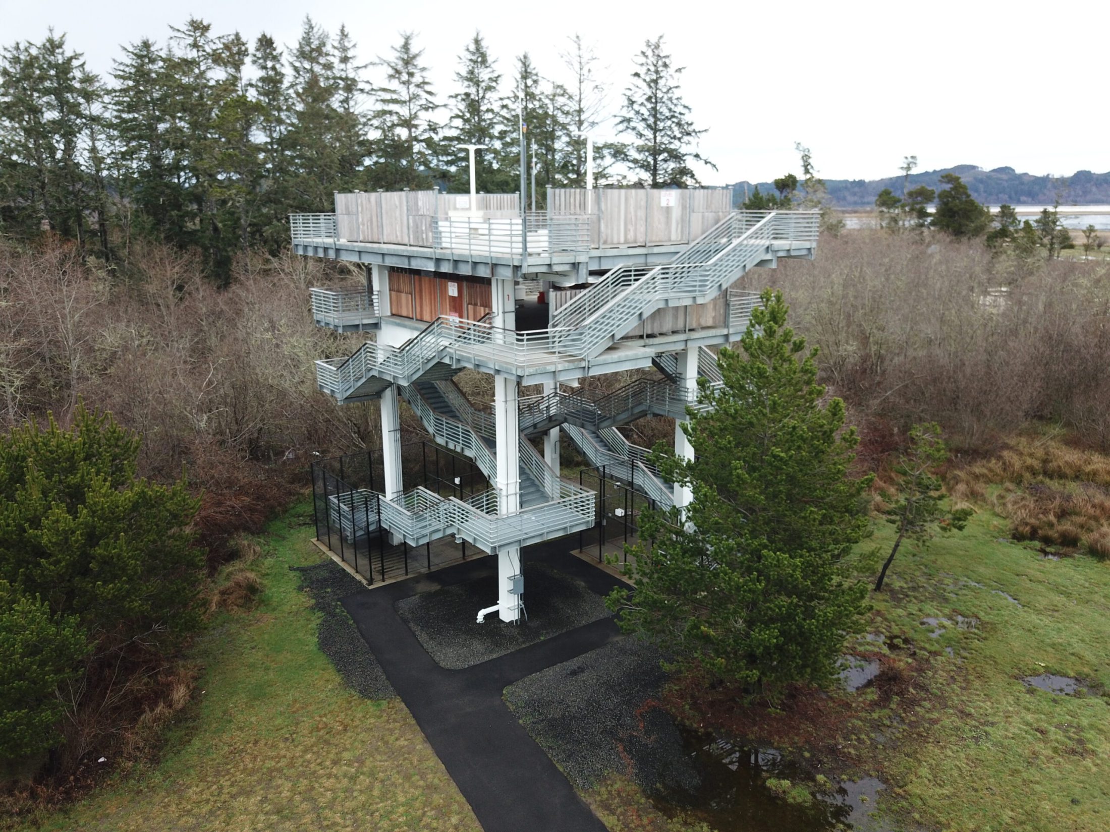
At the state level, attention has started to turn to mitigating the devastating potential of the Cascadia threat. Oregon’s Resilience Plan has outlined the scale of infrastructure upgrades needed to withstand a major earthquake, and lawmakers have started discussing funding strategies. One proposal expected before the Oregon Legislature in 2026 would allocate roughly three hundred million dollars toward expanding emergency training facilities, improving response coordination, and strengthening Oregon’s ability to respond when the next major disaster arrives.
Progress is slow, and sometimes frustratingly incremental. But each step increases the odds that more people will survive when the next Cascadia earthquake eventually strikes.
Heed the warning
More than three centuries ago, the people who lived along the Pacific Northwest coastline witnessed the earth shake and the ocean rise. Many people died. They didn’t have a complete understanding of how such destruction could be caused by the natural forces of the earth’s crust. Nevertheless, they remembered what happened and preserved it in stories, and for generations, those warnings lived in lore.
Today, science has uncovered the same story written in the geology of the Pacific Northwest. The disasters are caused by competing tectonic plates rather than battles between giant mythical creatures, but the result is the same: the ground will shake again, and the sea will rise. The difference now is that we know why—and we have the chance to prepare.
Whether the next great Cascadia earthquake comes tomorrow or decades from now, the warning has already been given. The question is no longer whether it will happen, but whether we will listen.

The Orphan Tsunami of 1700: Japanese Clues to a Parent Earthquake in North America
A puzzling tsunami entered Japanese history in January 1700. Samurai, merchants, and villagers wrote of minor flooding and damage. Some noted having felt no earthquake; they wondered what had set off the waves but had no way of knowing that the tsunami was spawned during an earthquake along the coast of northwestern North America. This orphan tsunami would not be linked to its parent earthquake until the mid-twentieth century, through an extraordinary series of discoveries in both North America and Japan.